
The FH-91 is a robust and cost-effective Medium Range Unmanned Aerial Vehicle (UAV) System engineered to deliver persistent, real-time intelligence, surveillance, and reconnaissance (ISR) capabilities to brigade-level units, border security forces, and disaster response teams. With an operational range of 100 km, endurance up to 12 hours, and a service ceiling of 7,000 meters, the FH-91 provides tactical commanders with actionable situational awareness across diverse terrain — from mountainous regions to coastal zones.
Designed for simplicity and resilience, the FH-91 features a high-wing monoplane configuration with a pusher propeller, enabling stable flight in turbulent conditions and excellent loiter performance. It is launched via a mobile rail launcher and recovered using a parachute-assisted landing with energy-absorbing skid, eliminating the need for runways or net systems.
Equipped with a stabilized electro-optical/infrared (EO/IR) payload and secure digital datalink, the FH-91 operates effectively day and night, in adverse weather, and in GPS-denied environments using advanced inertial navigation and terrain reference updates.
Key Features
- Tactical Endurance: Up to 12 hours of continuous flight for extended mission coverage.
- Operational Range: 100 km line-of-sight (LOS), with optional SATCOM upgrade for beyond-line-of-sight (BLOS) missions.
- All-Weather Capability: Operates in rain, snow, wind (up to Beaufort 5), and temperatures from -40°C to +60°C.
- Stabilized EO/IR Payload: HD daylight camera (1080p/4K) + uncooled thermal imager (640×512) on 2-axis gimbal for clear imaging at long ranges.
- Secure Datalink: AES-256 encrypted COFDM transmission with anti-jamming and frequency-hopping capabilities (C/L-band).
- Autonomous Flight: Fully automatic takeoff, waypoint navigation, orbit, return-to-home, and emergency auto-landing.
- GPS-Denied Navigation: Inertial Navigation System (INS) + Visual Odometry (VO) support for indoor or signal-degraded environments.
- Rapid Deployment: Entire system deployable within 20 minutes; launcher and ground control station (GCS) fit in standard military vehicles.
- Low Maintenance Design: Brushless motor or small gasoline engine; minimal moving parts; field-replaceable components.
- Modular Architecture: Open interface supports future integration of SAR, SIGINT, or communication relay payloads.
- Operator-Friendly GCS: Intuitive touchscreen interface with 3D map overlay, real-time video, and automated mission planning.
Technical Specifications
| Parameter | Specification |
|---|---|
| System Designation | FH-91 Medium Range UAV System |
| UAV Type | Fixed-wing, high-wing, pusher propeller |
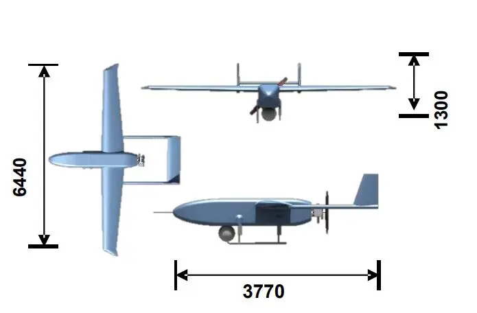
| Wingspan | 6.2 m |
| Length | 2.8 m |
| Height | 1.1 m |
| MTOW (Max Takeoff Weight) | 75 kg |
| Empty Weight | 42 kg |
| Payload Capacity | Up to 15 kg (internal bay) |
| Propulsion | Electric brushless motor (standard) or 2-stroke gasoline engine (extended range option) |
| Battery/Fuel | LiPo 22,000 mAh (electric); 8 L fuel (gasoline) |
| Cruise Speed | 100–130 km/h |
| Max Speed | 180 km/h |
| Stall Speed | 60 km/h |
| Service Ceiling | 7,000 m (23,000 ft) |
| Operating Altitude (AGL) | 100 – 6,000 m |
| Wind Resistance | Up to 65 km/h (Beaufort 5) |
| Flight Endurance | 8–12 hours (electric: 8h, gasoline: 12h) |
| Control Range (LOS) | Up to 100 km |
| BLOS Option | Iridium or GEO SATCOM |
| Communication Link | Dual-band COFDM (C/L-band), frequency-agile |
| Encryption | AES-256 |
| Navigation System | GPS/BeiDou + GLONASS + INS (MEMS) |
| Autonomous Functions | Auto takeoff, waypoint nav, orbit, RTL, auto-land |
| Launch Method | Rail launcher (pneumatic assist) |
| Recovery Method | Parachute + shock-absorbing skid |
| Ground Control Station (GCS) | Ruggedized laptop/tablet with dual-screen option |
| Crew | 1–2 operators (Pilot + Sensor Operator) |
| Power Supply | 24V DC (vehicle) or 220V AC |
| Operating Temperature | -40°C to +60°C |
| System Deployment Time | < 20 minutes |
| Transportability | Disassembled system fits in SUV or light truck |
Operational Roles
- Border & Coastal Surveillance: Long-duration monitoring of illegal crossings, smuggling, or infiltration.
- Tactical Reconnaissance: Real-time battlefield imaging for battalion/company-level units.
- Disaster Assessment: Post-earthquake, flood, or wildfire damage mapping and search support.
- Critical Infrastructure Protection: Patrol of pipelines, power lines, railways, and remote facilities.
- Law Enforcement: Support for anti-poaching, fugitive tracking, and large-scale event security.
- Communications Relay: Temporary UHF/VHF network extension in rugged terrain.
- Training Platform: Low-cost solution for UAV operator training and doctrine development.
Support & Export Configuration
The FH-91 is designed for global deployment with comprehensive support:
- Training program (basic flight, maintenance, mission planning)
- Spare parts kit (propellers, motors, sensors, batteries)
- Field charging unit and transport backpacks
- Mission planning software (offline maps, KML import, route optimization)
- Optional upgrades: Laser rangefinder, AIS receiver, lightweight SIGINT module
- Civil certification available for non-military use
Available in:
- Standard ISR Configuration (EO/IR only)
- Extended-Endurance Gasoline Variant
- SATCOM-BLOS Upgrade Kit
- Dual-Payload Bay Version (for sensor + relay combo)
Ideal for nations seeking a proven, low-risk, high-utility UAV platform without the complexity or cost of larger MALE systems.
System Composition
FH-91 UAV system consists of aircraft, task payload, command and control vehicle, transport and launch vehicle, receiving system.